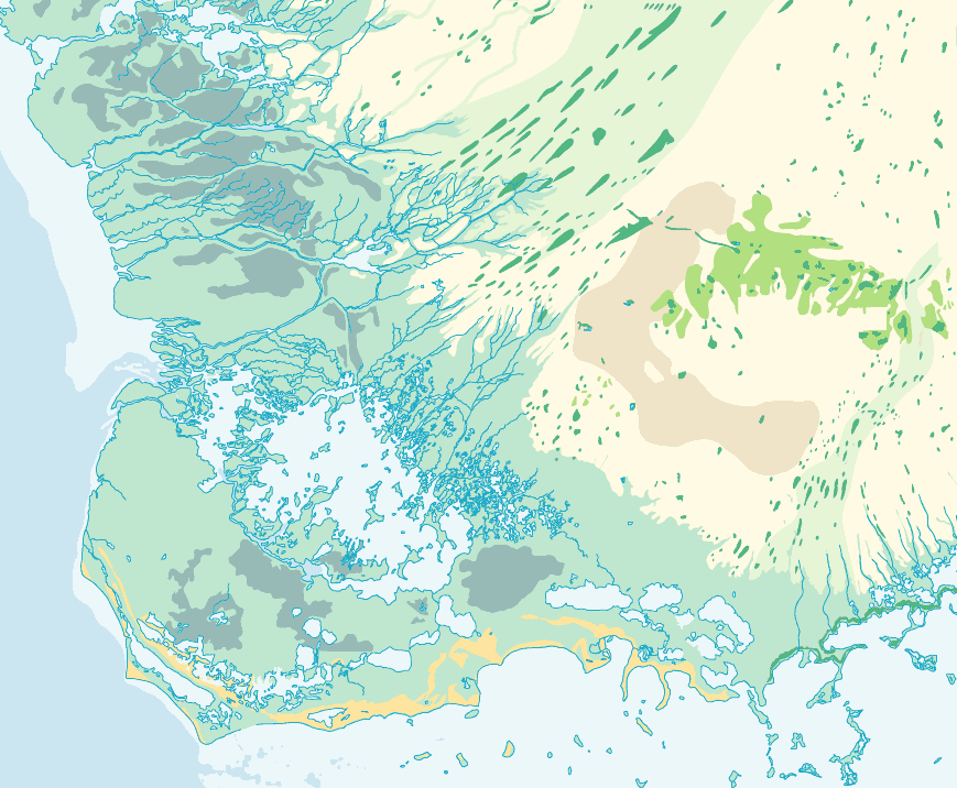
Description: This map of the Everglades National Park is a color-coded map of the various Everglades Ecosystems. The portion of the largest green spreading along the coast is coastal marsh. The orange lines are coastal prairie. The brightest green, in the middle right, is pineland. The speckles of dark teal are hardwood hammock.
Place Names: 1950-1999, Everglades,
ISO Topic Categories: inlandWaters, oceans
Keywords: Everglades National Park, physical, swamps, everglades, wetlands, physical features, inlandWaters, oceans, Unknown,1994
Source: , (, : National Park Service, 1994)
Map Credit: Courtesy the private collection of Roy Winkelman. |
|