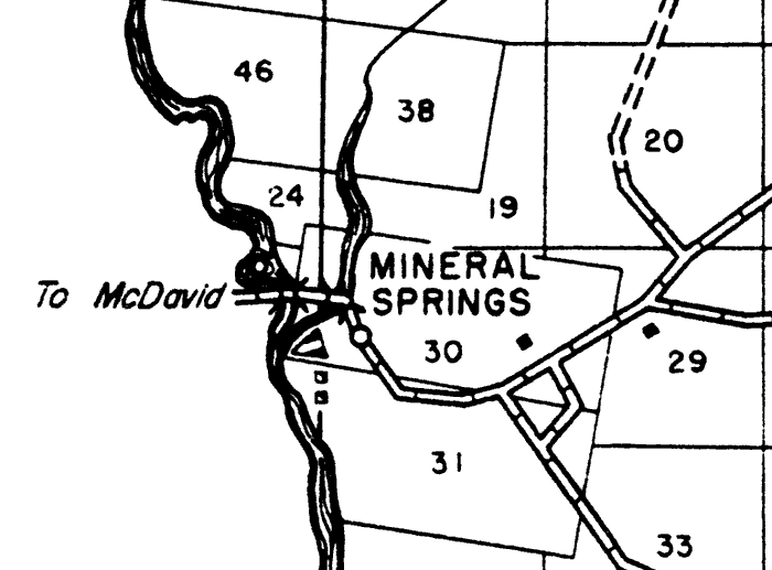
Description: This is a detailed map of the city Mineral Springs in Santa Rosa County, Florida. Section Township Range (STR) is shown. This map shows state roads, US highways, railroads, county seat, an airport, businesses, churches, cemeteries, camp, tenant houses, sawmill, farm units and dwellings other than farms. There is a road leading to McDavid from the Mineral Springs area. Key to Florida Highway maps.
Place Names: Santa Rosa, Mineral Springs, McDavid,
ISO Topic Categories: boundaries, transportation, location, inlandWaters
Keywords: Mineral Springs, physical, political, transportation, physical features, major political subdivisions, local jurisdictions, roads, railroads, boundaries, transportation, location, inlandWaters, Poloconic, 1940
Source: , Florida State Road Department (Tallahassee, FL: FDOT, 1940)
Map Credit: Courtesy the private collection of Roy Winkelman. |
|