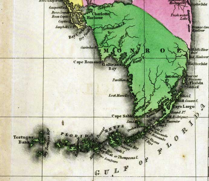
Description: This detail of a 1827 map shows major rivers, lakes, coastal features, settlements, and roads in Monroe County. The county is crossed by many waterways including the Caloosahatchee River, the Youngs River, and Gallivans Creek. The coast line features the Florida Keys, Gallivans Bay, Cape Sable, and the Dry Tortugas. Sections of proposed shipping canals are also shown.
Place Names: Monroe, Charlotte Harbor, Cape Romano, Caloosahatchee River, Cayo Largo, Middle River Island, New River Inlet, Elliss Island, Key West, Cape Sable, Dry Tortugas, Tortugas Bank, Pavillion Key, Gallivans Bay, North Creek, Lost Mans Keys,
ISO Topic Categories: boundaries, inlandWaters, oceans
Keywords: Detail - Geographical, statistical, and historical map of Florida, physical, political, historical, physical features, major political subdivisions, county borders, boundaries, inlandWaters, oceans, Unknown,1827
Source: Joseph Drayton, A complete historical, chronological, and geographical American atlas (Philadelphia, PA: Carey and Lea , 1827) Plate 37
Map Credit: Courtesy of the Special Collections Department, University of South Florida |
|