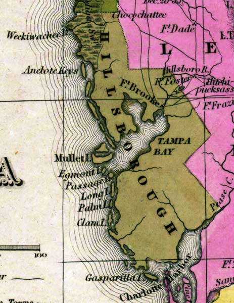
Description: This detail of a map from the Tanner's Universal Atlas shows towns, forts, roads, canals, major rivers and lakes in Hillborough County. The county ranges from Weekiwachee River in the north down to Charlotte Harbor in the south. In the middle is Tampa Bay. Along the coast, various keys are named. There are references to forts, battlefields, and routes used by the Army during the Seminole War. The Longitude is from the Washington Prime Meridian.
Place Names: Hillsborough, Clam Island, Palm Island, Long Island, Passage Island, Egmont Island, Mullet Island, Gasparilla Island, Charlotte Harbor, Fort Brooke, Fort Brook, Anclote Keys, Weekiwachee River, Tampa Bay,
ISO Topic Categories: boundaries, inlandWaters, oceans, society, transportation
Keywords: Detail - Florida, physical, political, transportation, historical, physical features, county borders, roads, other military, boundaries, inlandWaters, oceans, society, transportation, Unknown,1839
Source: Henry Schenck Tanner, Tanner's Universal Atlas (Philadelphia, PA: Carey & Hart, 1839) 21
Map Credit: Courtesy the private collection of Roy Winkelman |
|