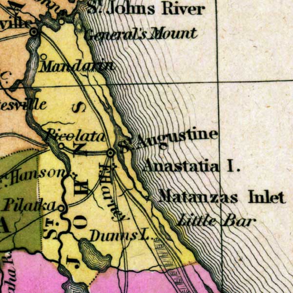
Description: This detail of a map from the Tanner's Universal Atlas shows towns, forts, roads, canals, major rivers and lakes in Saint Johns County. The Saint Johns River is the largest feature in this detail. Beyond this, there are other points if interest noted such as Mandarin, Saint Augustine, Anastasia Island, and Matanzas Inlet. There are references to forts, battlefields, and routes used by the Army during the Seminole War. The Longitude is from the Washington Prime Meridian.
Place Names: St. Johns, General's Mount, Mandarin, Picolata, Saint Augustine, Anastasia Island, Matanzas Inlet, Saint Johns River, Fort Harney, Dunns Lake,
ISO Topic Categories: boundaries, inlandWaters, oceans, society, transportation
Keywords: Detail - Florida, physical, political, transportation, historical, physical features, county borders, roads, other military, boundaries, inlandWaters, oceans, society, transportation, Unknown,1839
Source: Henry Schenck Tanner, Tanner's Universal Atlas (Philadelphia, PA: Carey & Hart, 1839) 21
Map Credit: Courtesy the private collection of Roy Winkelman |
|