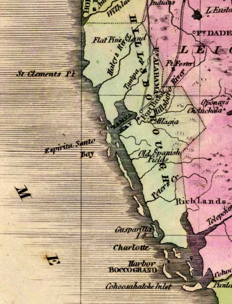
Description: This detail of a 1842 map of Florida shows roads, railroads, counties, forts, naval depots and other military installations, major towns, rivers, and lakes for Hillsborough County. In addition to listing the rivers and towns, this detail provides small descriptions of the land such as Flat Pine Land and Old Spanish Fields. Longitude is shown from Greenwich at the top of the map, and Washington at the bottom of the map. The map scale is in &quoe;American Miles."
Place Names: Hillsborough, Haley's River, Tampa River, Hillsboro River, Hillsborough River, Tampa Bay, Tampa, Peters Creek, St Clemens Point, Gasparilla Island, Fort Brook, Fort Alabama,
ISO Topic Categories: boundaries, inlandWaters, oceans, society
Keywords: Detail - Map of the State of Florida, physical, political, transportation, historical, physical features, major political subdivisions, county borders, roads, boundaries, inlandWaters, oceans, society, Unknown,1842
Source: Jeremiah Greenleaf, A New Universal Atlas (Brattleboro, VT: , 1842) 56
Map Credit: Courtesy the private collection of Roy Winkelman |
|