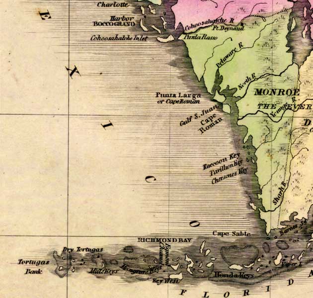
Description: This detail of a 1842 map of Florida shows roads, railroads, counties, forts, naval depots and other military installations, major towns, rivers, and lakes for the Monroe County. Several waterways traverse Monroe County including Delaware River, North River, Younge River, and Shark River. The Keys are detailed with labels. Longitude is shown from Greenwich at the top of the map, and Washington at the bottom of the map. The map scale is in &quoe;American Miles."
Place Names: Monroe, Cape Romano, Fort Deynaud, Delaware River, North River, Everglades, Shark River, Raccoon Key, Chersones Key, Cape Sable, Honda Keys, Key West, Dry Tortugas, Tortugas Bank,
ISO Topic Categories: boundaries, inlandWaters, oceans, society
Keywords: Detail - Map of the State of Florida, physical, political, transportation, historical, physical features, major political subdivisions, county borders, roads, boundaries, inlandWaters, oceans, society, Unknown,1842
Source: Jeremiah Greenleaf, A New Universal Atlas (Brattleboro, VT: , 1842) 56
Map Credit: Courtesy the private collection of Roy Winkelman |
|