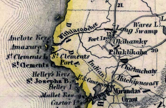
Description: Meyer's 1845 map of Florida is derived from the Tanner/Mitchell Universal atlas map of 1839. This detail of that map covers Hernando County, which was called Benton County between 1844 and 1850. However, this map shows it named as Dade County. Routes of travel are covered along with major waterways. One of these for this detail is the Withlacoochee River. Islands on the coast are pictured, such as Castor Island and Saint Clements Island.
Place Names: Hernando, Wares Lake, Long Swamp, Okihamky, Pilaklikaha, Chichuchaty, Hitchipucsasy, Mirandas Grant, Tampa Bay, Castor Island, Mullet Key, Saint Joseph's Bay, Helley's Keys, Saint Clements Cape, St Clements Port, Amaxura, Anclote Keys, Withlacoochee River, Fort Izard,
ISO Topic Categories: boundaries, inlandWaters, oceans, society, transportation
Keywords: Hernando County, physical, political, transportation, historical, physical features, major political subdivisions, roads, boundaries, inlandWaters, oceans, society, transportation, Unknown,1845
Source: Joseph Meyer, Grosser Hand-Atlas uber alle Theile der Erde (Hillsburghaus, : Hildburghausen: Bibliographischen Instituts, 1845) 148
Map Credit: Courtesy the private collection of Roy Winkelman |
|