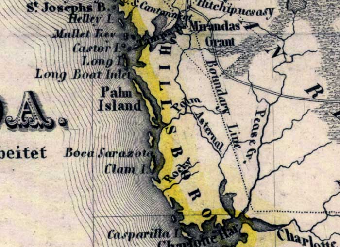
Description: Meyer's 1845 map of Florida is derived from the Tanner/Mitchell Universal atlas map of 1839. This detail of that map covers Hillsborough County. Routes of travel are covered along with major waterways. One of these for this detail is Tampa Bay. Islands on the coast are pictured, such as Palm Island and Clam Island.
Place Names: Hillsborough, Tampa, Tampa Bay, Palm Island, Asternal, Rocky, Clam Island, Casparilla Island, Boca Sarazota, Long Boat Island, Pease Creek,
ISO Topic Categories: boundaries, inlandWaters, oceans, society, transportation
Keywords: Hillsborough County, physical, political, transportation, historical, physical features, major political subdivisions, roads, boundaries, inlandWaters, oceans, society, transportation, Unknown,1845
Source: Joseph Meyer, Grosser Hand-Atlas uber alle Theile der Erde (Hillsburghaus, : Hildburghausen: Bibliographischen Instituts, 1845) 148
Map Credit: Courtesy the private collection of Roy Winkelman |
|