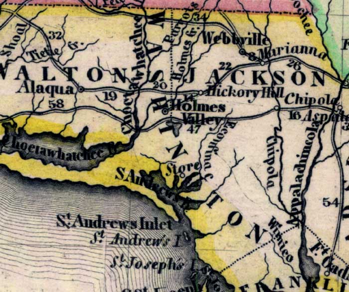
Description: Meyer's 1845 map of Florida is derived from the Tanner/Mitchell Universal atlas map of 1839. This detail of that map covers Washington County. Routes of travel are covered along with major waterways. This small county is traversed by the Choctawhatchee River. Many coastal feautres are labeled, such as the Saint Andrews Bay, Saint Joseph's Island, and Saint Andrew's Island.
Place Names: Washington, Choctawhatchee, Saint Andrews Bay, Saint Andrews Inlet, Saint Joseph's Island, Store, Holmes Valley, Hickory Hill,
ISO Topic Categories: boundaries, inlandWaters, oceans, society, transportation
Keywords: Washington County, physical, political, transportation, historical, physical features, major political subdivisions, roads, boundaries, inlandWaters, oceans, society, transportation, Unknown,1845
Source: Joseph Meyer, Grosser Hand-Atlas uber alle Theile der Erde (Hillsburghaus, : Hildburghausen: Bibliographischen Instituts, 1845) 148
Map Credit: Courtesy the private collection of Roy Winkelman |
|