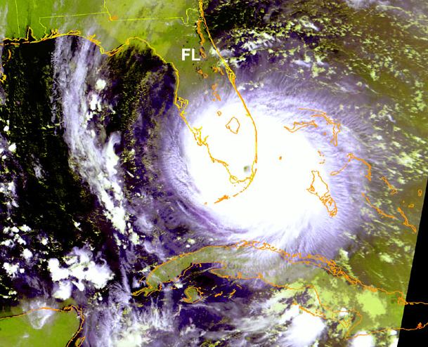
Description: This is a satellite image showing the position of Hurricane Andrew and its movement over Florida on August 24, 1992.
Place Names: 1950-1999, Hurricane Andrew
ISO Topic Categories: climatologyMeteorologyAtmosphere, boundaries, oceans, inlandWaters
Keywords: Hurricane Andrew, physical, meteorological, hurricane, khurricane, political, ksatellite, physical features, country borders, climatologyMeteorologyAtmosphere, boundaries, oceans, inlandWaters, Unknown,August 24, 1992
Source: National Oceanic and Atmospheric Administration, (Washington, DC: U. S. Department of Commerce, 1992)
Map Credit: Courtesy the U.S. National Oceanic and Atmospheric Administration |
|