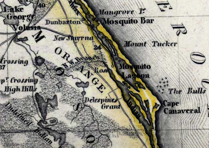
Description: Meyer's 1850 map of Florida is derived from the Tanner/Mitchell Universal atlas map of 1839, and similar to the 1845 maps. In this updated detail of Orange County, waterways and townships are noted. The major waterways shown are Indian River and Mosquito Lagoon. Coastal features include Mosquito Bar, Mount Tucker, and Cape Canaveral.
Place Names: Orange, Mosquito Bar, Mangrove Island, Mount Tucker, Mosquito Lagoon, The Bulls, Cape Canaveral, Dunbarton, New Smyrna, Ross, Indian River, Lake George, Volusia, Delespines Grant, Everglades, Halifax,
ISO Topic Categories: boundaries, inlandWaters, oceans, society, transportation
Keywords: Orange County, physical, political, transportation, historical, physical features, major political subdivisions, roads, boundaries, inlandWaters, oceans, society, transportation, Unknown,1850
Source: Joseph Meyer, Grosser Hand-Atlas uber alle Theile der Erde (Hillsburghaus, : Hildburghausen: Bibliographischen Instituts, 1850) 148
Map Credit: Courtesy the private collection of Roy Winkelman |
|