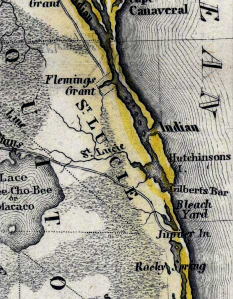
Description: Meyer's 1850 map of Florida is derived from the Tanner/Mitchell Universal atlas map of 1839, and similar to the 1845 maps. In this updated detail of Saint Lucie County, waterways and townships are noted. The major waterway shown is Indian River. Coastal features include Cape Canaveral, Hutchinsons Island, Gilberts Bar, and Rocky Spring.
Place Names: St. Lucie, Indian River, Hutchinsons Island, Flemings Grant, Saint Lucie, Gilberts Bar, Jupiter, Jupiter Inlet, Rocky Spring, Lace Kee-Cho-Bee, Lace Macaco, Lake Macaco,
ISO Topic Categories: boundaries, inlandWaters, oceans, society, transportation
Keywords: St. Lucie County, physical, political, transportation, historical, physical features, major political subdivisions, roads, boundaries, inlandWaters, oceans, society, transportation, Unknown,1850
Source: Joseph Meyer, Grosser Hand-Atlas uber alle Theile der Erde (Hillsburghaus, : Hildburghausen: Bibliographischen Instituts, 1850) 148
Map Credit: Courtesy the private collection of Roy Winkelman |
|