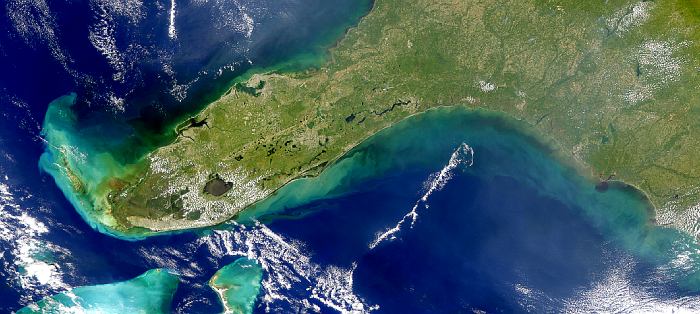
Description: This SeaWiFS image of Florida shows stirred up water and excess runoff along the coast from the Florida Keys to the Carolinas, the after-effects of Hurricane Irene, on October 18, 1999.
Place Names: 1950-1999, Hurricane Irene, Lake Okeechobee
ISO Topic Categories: location, inlandWaters, oceans, climatologyMeteorologyAtmosphere
Keywords: Hurricane Irene After-Effects, physical, hurricane, ksatellite, khurricane, meteorological, physical features, location, inlandWaters, oceans, climatologyMeteorologyAtmosphere, Unknown,October 18, 1999
Source: NASA Goddard Space Flight Center, (, : NASA Goddard Space Flight Center, 1999)
Map Credit: Courtesy of the SeaWiFS Project, NASA/Goddard Space Flight Center, and ORBIMAGE. |
|