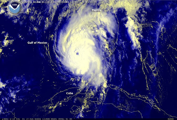
Description: This is a satellite image showing Hurricane Charley approaching the Florida coast on August 13, 2004 9:45 AM with winds near 110 mph and higher gusts.
Place Names: 2000-, Florida, Gulf of Mexico, Florida Keys, Cuba
ISO Topic Categories: climatologyMeteorologyAtmosphere, oceans, boundaries, inlandWaters
Keywords: Hurricane Charley Approaching Florida, physical, hurricane, khurricane, ksatellite, political, meteorological, country borders, climatologyMeteorologyAtmosphere, oceans, boundaries, inlandWaters, Unknown,August 13, 2004
Source: National Oceanic and Atmospheric Administration, (Washington , DC: U. S. Department of Commerce, 2004)
Map Credit: Courtesy the U.S. National Oceanic and Atmospheric Administration |
|