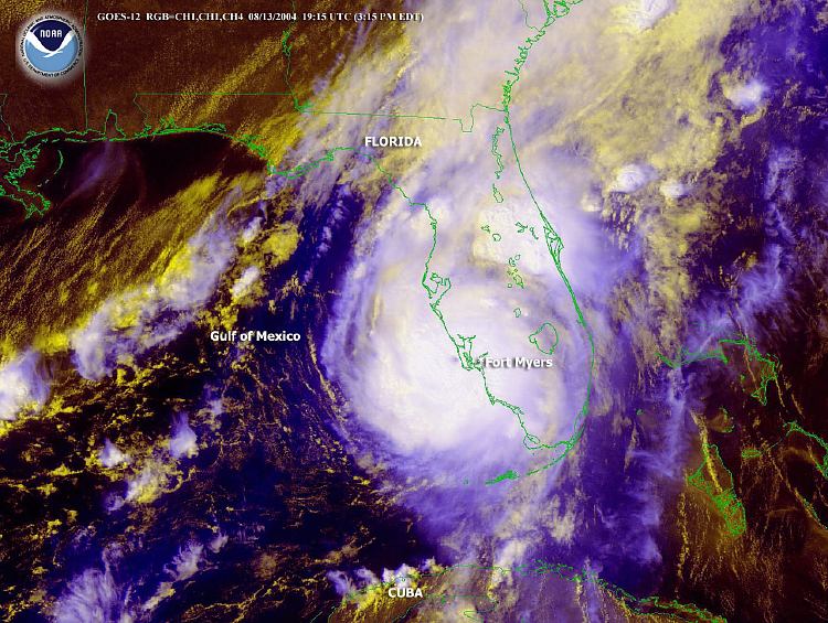
Description: This is a satellite image showing Hurricane Charley approaching Ft. Myers on August 13, 2004 at 3:15 PM. The National Hurricane Center estimated winds up to 145 mph near the eye of the storm and movement to the north-northeast at 20 mph.
Place Names: 2000-, Florida, Gulf of Mexico, Cuba, Fort Myers, Ft. Myers
ISO Topic Categories: climatologyMeteorologyAtmosphere, oceans, boundaries, inlandWaters
Keywords: Hurricane Charley Approaching Ft. Myers, physical, hurricane, khurricane, ksatellite, political, meteorological, country borders, climatologyMeteorologyAtmosphere, oceans, boundaries, inlandWaters, Unknown,August 13, 2004
Source: National Oceanic and Atmospheric Administration, (Washington , DC: U. S. Department of Commerce, 2004)
Map Credit: Courtesy the U.S. National Oceanic and Atmospheric Administration |
|