| Home > Maps > Escambia City and Local > Pensacola, 1860s | |
|
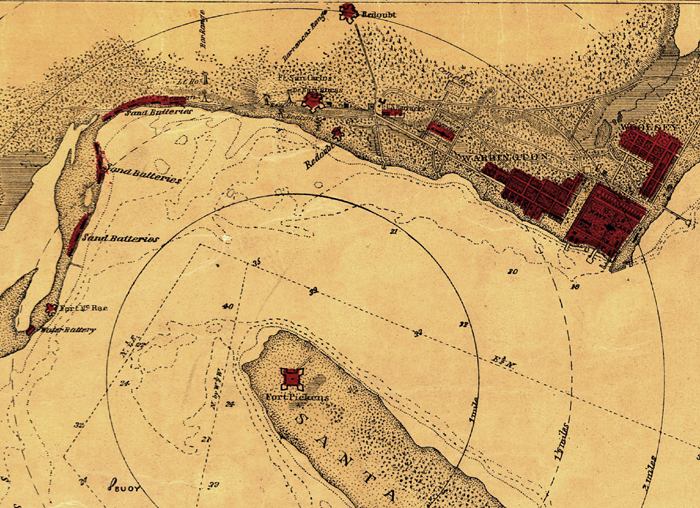
Sketch
of the Pensacola Navy Yard and Fort Pickens from U.S. coast surveys in
the 1860s. It indicates fortifications, roads, soundings, and half-mile
distance circles centered on Fort Pickens.
|
|
Map Credit: Courtesy of the Library of Congress, Geography and Map Division.
|
| Home > Maps > Escambia City and Local > Pensacola, 1860s |
Exploring
Florida: A Social Studies Resource for Students and Teachers
Produced by the Florida Center for Instructional
Technology,
College of Education, University of South Florida © 2002.