| Home > Maps > Escambia City and Local | |
Click on a thumbnail image to view a full size version of that map.
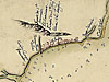
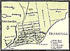
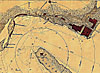
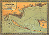
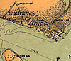
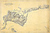
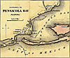
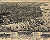
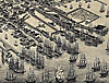
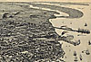
Detailed view of Pensacola from 1782. Detailed view of Pensacola from 1850. Sketch of the Pensacola Navy Yard and Fort Pickens from the 1860s. Topographical map of Pensacola Bay from the 1860s. Detailed view of Ft. San Carlos de Barracas and Ft. Pickens from the 1860s. Map of Warrington and its vicinity from the early 1860s. Map of the Pensacola Bay entrance from 1862. Perspective map of Pensacola from 1885. Detailed view of map of Pensacola in 1885. Detailed view of map of Pensacola in 1885.
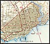
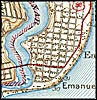
1942, Pensacola, Florida. Detail view from a United States Geological Survey map
1942, Pensacola-east, Florida. Detail view from a United States Geological Survey map
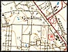
1942, Pensacola-Goulding, Florida. Detail view from a United States Geological Survey map
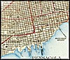
1942, Pensacola-waterfront, Florida. Detail view from a United States Geological Survey map
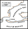
Fort Pickens and Pensacola. Also available in a PDF verison for printing.
| Home > Maps > Escambia City and Local |
Exploring
Florida: A Social Studies Resource for Students and Teachers
Produced by the Florida Center for Instructional
Technology,
College of Education, University of South Florida © 2002.