| Home > Maps > Aerial > Cape Canaveral Area | |
|
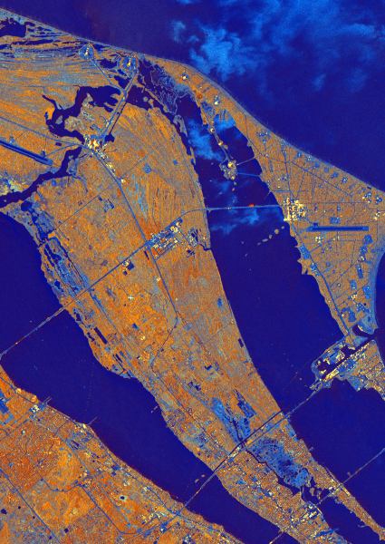
This radar image from October 4, 1994, shows the east coast of central
Florida, including the Cape Canaveral area. The Indian River, Banana River
and the Atlantic Ocean are the three bodies of water (shown in deep blue)
from the lower left to the upper right of this false color image. Parts
of NASA's John F. Kennedy Space Center (KSC) and the Cape Canaveral Air
Station (CCAS) are visible. KSC occupies much of Merritt Island in the
center of the image, as well as, the northern part of Cape Canaveral along
the right side of the image.
|
|
Map Credit: Courtesy of NASA JLP.
|
| Home > Maps > Aerial > Cape Canaveral Area |
Exploring
Florida: A Social Studies Resource for Students and Teachers
Produced by the Florida Center for Instructional
Technology,
College of Education, University of South Florida © 2002.