|
|
|
| FL Maps > County > Levy |
Click on a thumbnail image to view a full size version of that map.
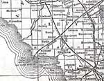
Levy County is Florida's 26th county, established on March 10, 1845, from a segment of Alachua County. It gains its name from David Levy Yulee, who served as the first U.S. Senator for Florida. Bronson is the county seat.
For earlier maps of this area, visit the Alachua County map gallery.
|
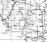
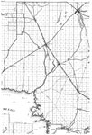
Levy County,
1920 |
|
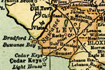
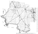
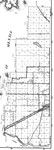
Levy County,
1920 |
|
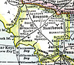
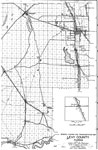
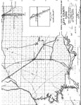
Levy County,
1921 |
|
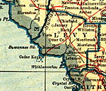
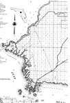
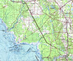
Levy County,
1921 |
|
Levy County,
1932 |
|
Levy,
1936 |
|
Levy East,
1936 |
|
Levy West,
1936 |
|
Levy Middle,
1936 |
|
Levy North,
1936 |
|
Levy Southeast,
1936 |
|
Levy County,
1975 |
|
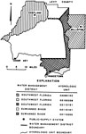
Water Management Districts and Hydrologic Units for Levy County,
1981 |
|
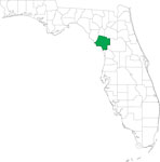
Locater Map of Levy County,
2008 |
|
Clipart Collection: Levy County Maps in 50 Colors,
2008 |
|
Plain Frames Collection: Levy County Maps in 30 Colors,
2008 |
|
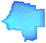
Fancy Frames Collection: Levy County Maps in 30 styles,
2008 |

|
Florida Photo Collection: Levy County Maps in 30 styles,
2008 |
|
Florida Waterways: Levy County Outline,
2008 |
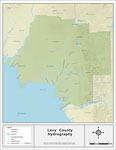
|
Florida Waterways: Levy County ,
2008 |
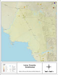
|
Sinkholes of Levy County, Florida ,
2008 |
|
Florida Waterways: Levy County Outline without Labels,
2008 |
|
Levy "Abstract" Style Maps in 30 Styles,
2008 |
|
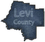
Levy County "Fun" Maps in 30 Styles,
2008 |
|
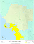
Florida Seagrass: Levy,
2008 |
| First | Previous | Next | Last |
| FL Maps > County > Levy |
Maps ETC
is a part of the
Educational Technology Clearinghouse
Produced by the
Florida Center for Instructional Technology
© 2007
College of Education
,
University of South Florida