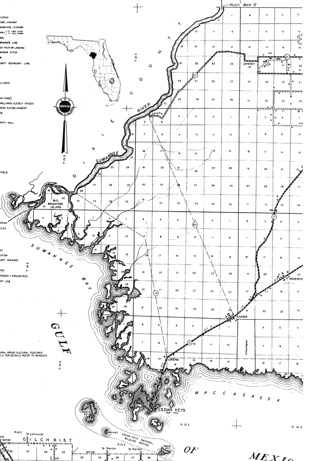
Description: This is a detailed map of the west portion of the county of Levy in the state of Florida. Section Township Range (STR) is shown. This map shows all of the main cities, state roads, churches, businesses, a post office, a tenant house, farm units and dwellings other than farms. Key to Florida Highway maps.
Place Names: Levy, Suwannee River, Janney, Vista, Big Bradford Island, Rosewood, Lukens, Cedar Key, Sumner
ISO Topic Categories: boundaries, location, transportation, inlandWaters
Keywords: Levy West, physical, political, transportation, physical features, major political subdivisions, local jurisdictions, roads, boundaries, location, transportation, inlandWaters, Unknown,1936
Source: , Florida State Road Department (, FL: , 1936)
Map Credit: Courtesy the private collection of Roy Winkelman. |
|