|
|
|
| FL Maps > County > Lake |
Click on a thumbnail image to view a full size version of that map.
Lake County is Florida's 43rd county, established on May 27, 1887, from segments of Sumter County and Orange County. It gains its name from the abundance of lakes found in this area. Tavares is the county seat.
For earlier maps of this area, visit the Sumter County and Orange County map galleries.
|
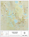
Sinkholes of Lake County, Florida ,
2008 |
|
Florida Waterways: Lake County Outline without Labels,
2008 |

|
Lake "Abstract" Style Maps in 30 Styles,
2008 |

|
Lake County "Fun" Maps in 30 Styles,
2008 |
|
Lake County Cities with Labels,
2009 |
|
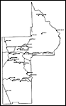
Lake County Cities Outline,
2009 |
|
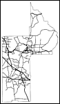
Lake County Road Network- Black and White,
2009 |
|
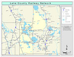
Lake County Railway Network- Black and White,
2009 |
|
Lake County Railway Network- Color,
2009 |
|
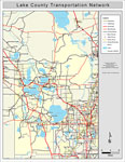
Lake County Road Network- Color,
2009 |
|
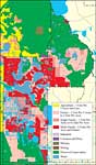
Withlacoochee River Watershed Distribution of Generalized Future Land Use, Ca. 2010- Lake County,
May 9, 2001 |
|
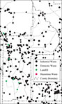
Withlacoochee River Watershed Distribution of Hazardous Waste Clean Up Sites, Landfills and Wastewater Facilities- Lake County,
May 9, 2001 |
|
Withlacoochee River Watershed Distribution of Soil Hydrologic Groups- Lake County,
May 9, 2001 |
|
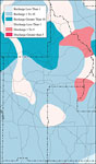
Withlacoochee River Watershed Recharge to/Discharge from the Floridan Aquifer In Inches Per Year- Lake County,
May 9, 2001 |
|
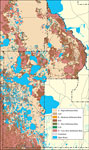
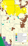
Withlacoochee River Watershed Distribution of Conservation Lands- Lake County,
May 9, 2001 |
|
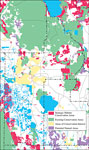
Withlacoochee River Watershed Strategic Habitat Conservation Areas, Areas of Conservation Interest, and Potential Natural Areas- Lake County,
May 9, 2001 |
| First | Previous |
| FL Maps > County > Lake |
Maps ETC
is a part of the
Educational Technology Clearinghouse
Produced by the
Florida Center for Instructional Technology
© 2007
College of Education
,
University of South Florida