Maps Site map
  FL Maps > State > 1760-1779
Site Map  

  Record   1   to   10  of   10

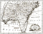
A new and correct map of the provinces of North & South Carolina, Georgia and Florida, 1762
Digitization provided by the USF Libraries Digitization Center. Rare Maps Collection: G3863 1762 .G53 Notes from USF Library: Pictorial relief. Shows drainage, roads, etc./ In: The American gazetteer ... l762. v. 1, opp. "Carolina." Scale [...

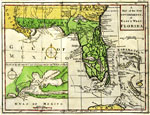
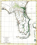
A Map of the New Governments of East and West Florida, 1763
Digitization provided by the USF Libraries Digitization Center. Rare Maps. An increasingly scarce map of Florida, just after its acquisition from Spain by Great Britain at the end of the French and Indian War, and its division into two Governments, E...

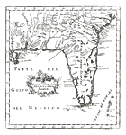
Carta Rappresentante la Penisola della Florida, 1763
Digitization provided by the USF Libraries Digitization Center. Rare Maps. This is a map of Florida from Italy, circa 1763. It also includes part of the southeast U. S. including South Carolina and Georgia. It shows cities, towns and inland waters. M...

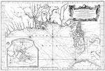
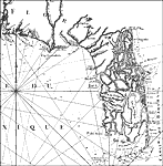
Carte reduite des costes de la Louisiane et de la Floride, 1764
Digitization provided by the USF Libraries Digitization Center. Rare Maps Collection: G3330 1764 .B45 Notes from USF Library: ''dressee au Depost des cartes, plans et journaux de la Marine pour le service des vaisseaux du roy par le S. Bellin, ingen...

East Florida, from surveys made since the last peace, adapted to Dr. Stork's History of that country, 1764
Digitization provided by the USF Libraries Digitization Center. Rare Maps. This is a map of Florida showing main cities, inland waters, etc mainly from East Florida. Relief shown pictorially. Prime meridians: London and Ferro. A manuscript scale of 1...

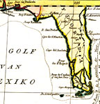
Carte reduite des costes de la Louisiane et de la Floride: Florida, 1764
A portion of Bellin's 1764 map of the Gulf Coast of Florida and Louisiana. This map details the peninsula of Florida and includes the panhandle west to Mobile Bay. The peninsula as depicted in this map is comprised of a series of islands and intrica...

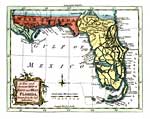
A new and accurate map of East and West Florida drawn from the authorities, 1765
Digitization provided by the USF Libraries Digitization Center. Rare Maps. This is a map of Florida showing the East and West portions, circa 1765. West Florida extends to the Mississippi River taking in New Orleans. This map also shows exaggerated i...

Algemeene Kaart van de Westindische Eilanden, 1769
A detail of Tirion's map of the West Indies showing only Florida. Digitization provided by the USF Libraries Digitization Center. Rare Maps Collection: G4900 1769 .T57 Notes from USF Library: A map of the Caribbean, also showing southern Florida, par...

The coast of West Florida and Louisiana. , 1775
The full title of this map is "The Coast Of West Florida and Louisiana By Thos. Jefferys Geographer to His Majesty. The Peninsula and Gulf of Florida or Channel of Bahama with the Bahama Islands." This is primarily a navigational chart with...

Detail - The coast of West Florida and Louisiana. , 1775
A detail from the 1775 map: "The Coast Of West Florida and Louisiana By Thos. Jefferys Geographer to His Majesty. The Peninsula and Gulf of Florida or Channel of Bahama with the Bahama Islands." This is primarily a navigational chart with s...


  FL Maps > State > 1760-1779
Site Map  

Maps ETC is a part of the Educational Technology Clearinghouse
Produced by the Florida Center for Instructional Technology © 2007
College of Education , University of South Florida