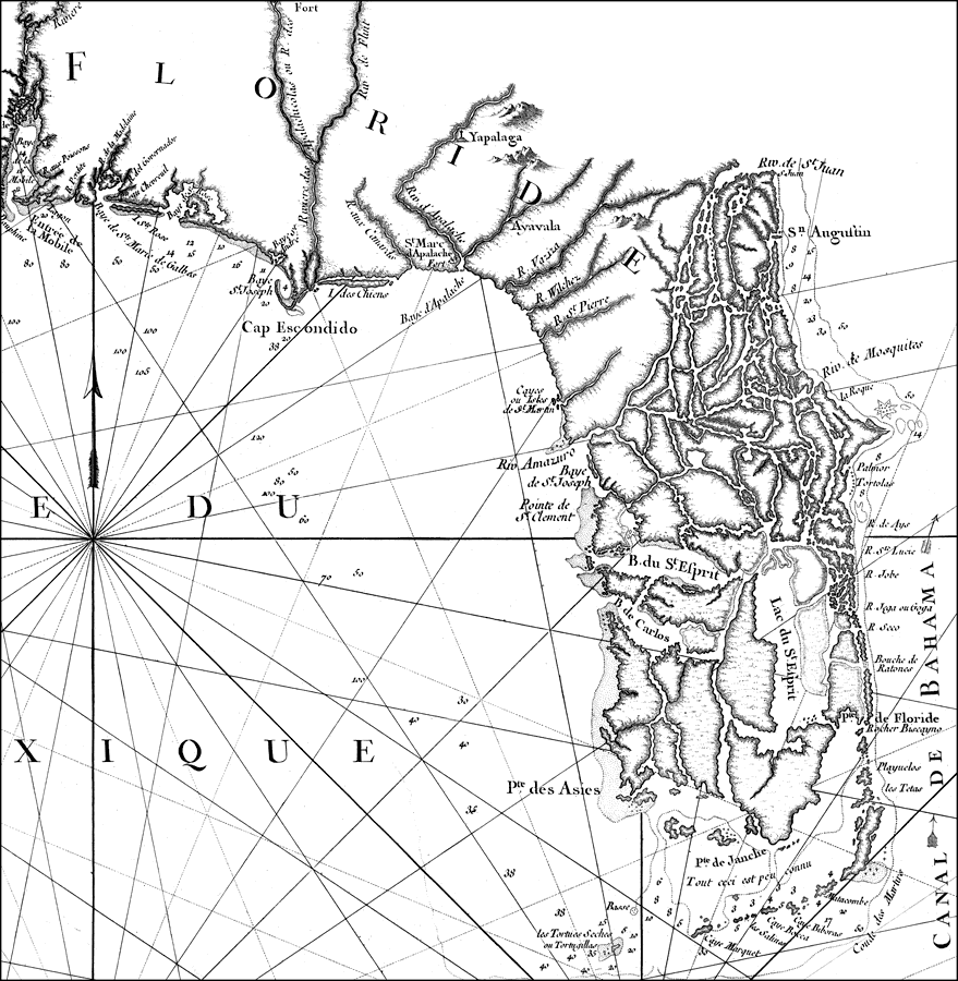
Description: A portion of Bellinís 1764 map of the Gulf Coast of Florida and Louisiana. This map details the peninsula of Florida and includes the panhandle west to Mobile Bay. The peninsula as depicted in this map is comprised of a series of islands and intricate waterways south and east of the Riv de St. Juan (St. Johns River) and Riv Amazuro (possibly Anclote River). A connecting waterway is shown between B. du St. Esprit (Tampa Bay), Lac du St. Esprit (Lake Okeechobee), and Rocher Biscayno (Key Biscayne).Digitization provided by the USF Libraries Digitization Center. Rare Maps Collection: G3330 1764 .B45 Notes from USF Library: ''dressee au Depost des cartes, plans et journaux de la Marine pour le service des vaisseaux du roy par le S. Bellin, ingenieur de la marine et du Depost des cartes a.'' Prime meridian: Paris./ Relief shown pictorially./ Depths shown by soundings. Inset: 'Carte des embouchures du fleuve St. Louis'. Scale [ca. 1:2,500,000]; W 97019'46"--W 77059'46"/N 33030'00"--N 22000'00" Measurements.Dimensions: 57 x 85 cm.
Place Names: 1760-1779, Cape Canaveral, Saint Augustine
ISO Topic Categories: inlandWaters, oceans
Keywords: Carte reduite des costes de la Louisiane et de la Floride: Florida, physical, historical, physical features, inlandWaters, oceans, Unknown,1764
Source: Jacques Nicolas Bellin, (Paris, : Deput des cartes et plans de la marine, 1764)
Map Credit: Courtesy of the Special Collections Department, University of South Florida. |
|
