Maps Site map
  FL Maps > County > Holmes
Site Map  

Holmes County Maps

Click on a thumbnail image to view a full size version of that map.

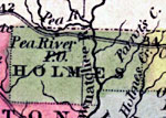
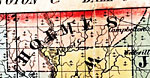
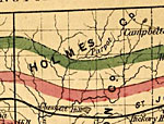
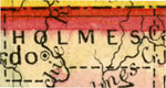
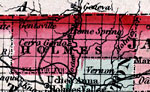
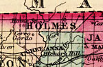
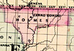
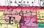
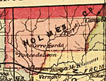
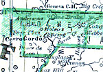
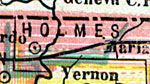
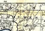
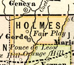
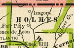
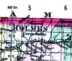
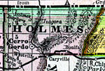
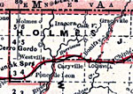
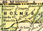
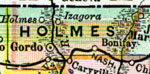
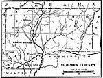
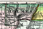
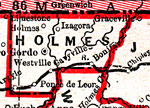
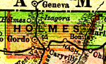
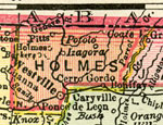
Holmes County is Florida's 27th county, established on January 8, 1848, from segments of Walton County and Jackson County. It gains its name from Holmes Creek, which serves as the eastern boundary of the county. Bonifay is the county seat.

For earlier maps of this area, visit the Walton County and Jackson County map galleries.
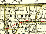

  Record   1   to   25  of   68

Holmes County, 1850
This detail of a 1850 map from the New Universal Atlas shows towns, forts, roads, canals, major rivers and lakes in Holmes County. The map is very similar to the 1839 map from Tanner's Universal Atlas. There are references to forts, battlefields, an...

Holmes County, 1856
This detail of a map from the annual report of the Surveyor General in 1856 shows Holmes County. Drainage, cities and towns, roads, trails, and location of railroad lines are shown in great detail. Parrot Creek travels the county....

Holmes County, 1859
Railroad map of Holmes County, Florida showing cities and towns, inland water, roads and railroads in 1859. Township grids based on the Tallahassee basis parallel and the Tallahassee prime meridian shows the extent of land survey in Florida. The map ...

Holmes County, 1860
A map of Holmes County as of 1860 showing rivers and the county seat....

Holmes County, 1860
Map of Holmes county, current to 1860, shows county lines, lakes, numerous forts. Gentsville, Homes Spring, and Cerro Gordo are among the features of this map....

Holmes County, 1863
This detail of a map of Florida was "Entered according to Act of Congress in the year 1863 by A. J. Johnson in the clerks office of the District Court of the United States for the Southern District of New York." It shows Holmes County in co...

Holmes County, 1871
This 1871 detail of Florida shows county lines and county seats current to the period, major towns and cities, and railroad routes and stations for Holmes County. The major water features of this detail are the Choctawhatchee River and the Parrot Riv...

Holmes County, 1873
This detail of a 1873 map of Florida, Georgia, and South Carolina shows an in color portrait of county lines of the period, Florida railroad routes, forts, and outlines major waterways for Holmes County. The major water feature of the detail is the C...

Holmes County, 1874
This detail of a map of Florida indicates Holmes County current to 1874. It shows drainage, township and county boundaries, cities and towns, battlefields, and submarine cables to Havana. It also lists operating and newly chartered railroads of the t...

Holmes County, 1880
This map of Holmes County shows the county seat (Cerro Gordo) and cities current to 1880....

Holmes County, 1880
A map of Holmes County showing county lines, the county seat (Cerro Gordo), railroads, and cities current to the 1880s....

Holmes County, 1882
This detail of a map of Florida covers Holmes County and vicinity and indicates drainage, cities and towns, township and county boundaries, railroads, and the 15-mile railroad land grant limits surrounding the track. The major water features of the d...

Holmes County, 1883
A map of Holmes County showing county lines, and the county seat (Cerro Gordo) current to 1883....

Holmes County, 1886
A map of Holmes County showing county lines, the county seat (Cerro Gordo), and railroads connecting the major cities current to 1886....

Holmes County, 1886
This is a detailed map of Holmes County, Florida showing the County Seat, major cities, roads, railroads, inland waters, etc. Township and range grid established from the Tallahassee baseline and meridian shows the extent of land survey in the county...

Holmes County, 1888
A map of Holmes County showing county lines, the county seat (Cerro Gordo), railroads, and cities current to 1888....

Holmes County, 1889
This is a detail of a map of Florida showing counties, railroads, cities, inland waters, etc for Holmes County. Each color represents a different route. The origin and destination for each route is found on the main map in an Explanation key. Feature...

Holmes County, 1890
A map of Holmes County showing towns, bodies of water, county lines, the county seat (Cerro Gordo), and railroads connecting the major cities current to 1890. ...

Holmes County, 1890
A map of Holmes County showing county lines, the county seat (Cerro Gordo), railroads, and cities current to 1890....

Holmes County, 1890
A map of Holmes County showing the county seat (Cerro Gordo), cities, towns, rivers, lakes, roads, and railroads present in 1890....

Holmes County, 1892
This detail of a map of Florida indicates Holmes County current to 1892. Major waterways are shown with thin, concentric lines. The thick black lines represent railroads. The central features of the detail include Cerro Gordo, Bonifay, and Holmes....

Holmes County, 1893
A map of Holmes County showing county lines, the county seat (Cerrro Gordo), and railroads connecting the major cities current to 1893....

Holmes County, 1894
A map of Holmes County showing county lines, the county seat (Cerro Gordo), railroads, and cities current to 1894....

Holmes County, 1895
This Florida map of Holmes County outlines the county boundary and railroads connecting the major cities, current to 1895. ...

Holmes County, 1897
A map of Holmes County showing forts, towns, bodies of water, county lines, the county seat (Westville), and railroads connecting the major cities current to 1897. Township and Range grids extending from the Tallahassee Meridian and Tallahassee Base ...

Next Last


  FL Maps > County > Holmes
Site Map  

Maps ETC is a part of the Educational Technology Clearinghouse
Produced by the Florida Center for Instructional Technology © 2007
College of Education , University of South Florida