|
|
|
| FL Maps > County > Marion |
Click on a thumbnail image to view a full size version of that map.
Marion County is Florida's 24th county, established on March 14, 1844, from segments of Alachua County and Mosquito County (Orange County). It gains its name from General Francis Marion, known as the "Swamp Fox" during the Revolutionary War because of his guerrilla tactics against the British forces. Ocala is the county seat.
For earlier maps of this area, visit the Alachua County and Mosquito County (Orange County) map galleries.
|
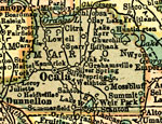
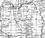
Marion County,
1920 |
|
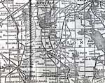
Marion County,
1920 |
|
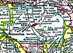
Marion County,
1921 |
|
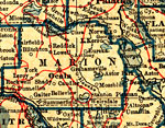
Marion County,
1921 |
|
Marion County,
1932 |
|
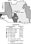
Water Management Districts and Hydrologic Units for Marion County,
1981 |
|
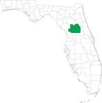
Locater Map of Marion County,
2008 |

|
Clipart Collection: Marion County Maps in 50 Colors,
2008 |
|
Plain Frames Collection: Marion County Maps in 30 Colors,
2008 |
|
Fancy Frames Collection: Marion County Maps in 30 styles,
2008 |

|
Florida Photo Collection: Marion County Maps in 30 styles,
2008 |
|
Florida Waterways: Marion County Outline,
2008 |
|
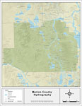
Florida Waterways: Marion County ,
2008 |
|
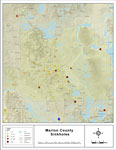
Sinkholes of Marion County, Florida ,
2008 |
|
Florida Waterways: Marion County Outline without Labels,
2008 |

|
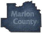
Marion "Abstract" Style Maps in 30 Styles,
2008 |
|
Marion County "Fun" Maps in 30 Styles,
2008 |
|
Marion County Cities with Labels,
2009 |
|
Marion County Cities Outline,
2009 |
|
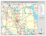
Marion County Road Network- Black and White,
2009 |
|
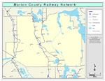
Marion County Railway Network- Black and White,
2009 |
|
Marion County Railway Network- Color,
2009 |
|
Marion County Road Network- Color,
2009 |
|
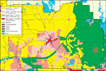
Withlacoochee River Watershed Distribution of Generalized Future Land Use, Ca. 2010- Marion County,
May 9, 2001 |
|
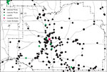
Withlacoochee River Watershed Distribution of Hazardous Waste Clean Up Sites, Landfills and Wastewater Facilities- Marion County,
May 9, 2001 |
| First | Previous | Next | Last |
| FL Maps > County > Marion |
Maps ETC
is a part of the
Educational Technology Clearinghouse
Produced by the
Florida Center for Instructional Technology
© 2007
College of Education
,
University of South Florida