Maps Site map
  FL Maps > County > Pasco
Site Map  

Pasco County Maps

Click on a thumbnail image to view a full size version of that map.

Pasco County is Florida's 45th county, established on June 2, 1887, from a segment of Hernando County. It gains its name from Samuel Pasco of Monticello. At the time the county was named, he was Speaker of the Florida House of Representatives. He later went on to serve in the United States Senate. Dade City, named after Major Francis Langhorne Dade, U.S. Army, is the county seat. Dade was killed by Seminoles on December 28, 1835, when his detachment of 110 men were ambushed and slaughtered in what became known as "The Dade Massacre."

For earlier maps of this area, visit the Hernando County map gallery.


  Record   51   to   72  of   72

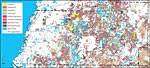
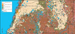
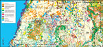
Pasco "Abstract" Style Maps in 30 Styles, 2008
A collection of 30 Pasco County maps in a range of abstract graphic styles suitable for use in presentations and websites. Since the style is abstract, these maps can be used in projects on a wide variety of topics. Each of the maps is in the JPEG fo...

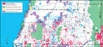
Pasco County "Fun" Maps in 30 Styles, 2008
A collection of 30 Pasco County maps in a crazy range of styles including blue jeans, chalkboards, pirate maps, coins, hearts, and even swimming pools. Use them as attention-getting slides in presentations or on websites. Each of the maps is in the ...

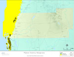
Florida Seagrass: Pasco, 2008
This topographical map was created by FCIT and shows the seagrass distribution for Pasco County. The green coloration depicts continuous seagrass while the yellow shows discontinuous seagrass. In addition to the seagrass, rivers, towns, and highways...

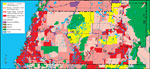
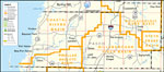
Pasco County Cities with Labels, 2009
This is a black and white city map of Pasco county, 2009. It shows the location with names of unincorporated cities/towns (black dot) such as Bayonet Point, incorporated cities/towns (circle with dot) such as New Port Richey, and the county seat (cir...

Pasco County Cities Outline, 2009
This is a black and white city outline map of Pasco county, 2009. It shows the location without names of unincorporated cities/towns (black dot), incorporated cities/towns (circle with dot), and the county seat (circle with star)....

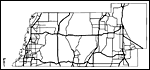
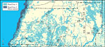
Pasco County Road Network- Black and White, 2009
This is a black and white road map of Pasco county, 2009. It shows the location of many roads, including US-19, SR-52 and I-75. ...

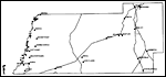
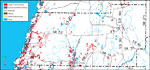
Pasco County Railway Network- Black and White, 2009
This is a black and white railroad map of Pasco county, 2009. It also shows location of cities and towns including New Port Richey and Zephyrhills....

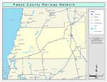
Pasco County Railway Network- Color, 2009
This is a color railroad map of Pasco county, 2009. It also shows location of cities and towns including New Port Richey and Zephyrhills, inland water including rivers and lakes, and Amtrak stations....

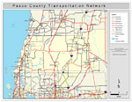
Pasco County Road Network- Color, 2009
This is a color road map of Pasco county, 2009. It shows the location of many roads including US-41 and I-75, cities and towns, and inland water....

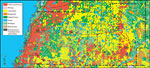
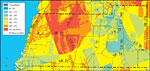
Withlacoochee River Watershed Distribution of 1995 Land Use/Cover- Pasco County, May 9, 2001
This is a county detail map of Pasco County extracted from the Southwest Florida Watershed Management District or SWFWMD Withlacoochee River Watershed Distribution of 1995 Land Use/Cover map, created on May 9, 2001. Land use/cover classifications sho...

Withlacoochee River Watershed Distribution of Generalized Future Land Use, Ca. 2010- Pasco County, May 9, 2001
This is a detail map of Pasco County extracted from the Southwest Florida Watershed Management District or SWFWMD Withlacoochee River Watershed Distribution of Generalized Future Land Use, ca. 2010 map, created on May 9, 2001. Land use/cover informat...

Withlacoochee River Watershed Distribution of 1995 Agricultural Land Use/Cover- Pasco County, May 9, 2001
This is a detail map of Pasco County extracted from the Southwest Florida Watershed Management District or SWFWMD Withlacoochee River Distribution of 1995 Agricultural Land Use/Cover map, created on May 9, 2001. Agricultural land use/cover classifica...

Withlacoochee River Watershed Distribution of Hazardous Waste Clean Up Sites, Landfills and Wastewater Facilities- Pasco County, May 9, 2001
This is a detail map of Pasco County extracted from the Southwest Florida Watershed Management District or SWFWMD of the Withlacoochee River Watershed Distribution of Hazardous Waste Clean Up Sites, Landfills and Wastewater Facilities map, created on...

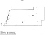
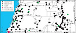
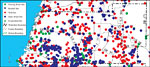
Withlacoochee River Watershed Distribution of Water Management Data Base Monitoring Sites- Pasco County, May 9, 2001
This is a detail map of Pasco County extracted from the Southwest Florida Watershed Management District or SWFWMD Withlacoochee River Watershed Distribution of Water Management Data Base Monitoring Sites map, created on May 9, 2001. This map shows fl...

Withlacoochee River Watershed Distribution of Soil Hydrologic Groups- Pasco County, May 9, 2001
This is a detail map of Pasco County extracted from the Southwest Florida Watershed Management District or SWFWMD Withlacoochee River Watershed Distribution of Soil Hydrologic Groups map, created on May 9, 2001. This map shows the following soil hydr...

Withlacoochee River Watershed Ground Water Pollution Potential to the Floridan Aquifer (D.R.A.S.T.I.C.)- Pasco County, May 9, 2001
This is a detail map of Pasco County extracted from the Southwest Florida Watershed Management District or SWFWMD Withlacoochee River ground water pollution potential to the Floridian aquifer map, created on May 9, 2001. The pollution potential is sh...

Withlacoochee River Watershed Distribution of FEMA 100-Year Flood Zones- Pasco County, May 9, 2001
This is a detail map of Pasco County from the Southwest Florida Watershed Management District or SWFWMD Withlacoochee River watershed distribution of FEMA 100-year flood zones map, created on May 9, 2001. Flood Zone A is shown in light teal and Flood...

Withlacoochee River Watershed Distribution of 1995 Urban Land Use Within the FEMA 100-Year Flood Zone- Pasco County, May 9, 2001
This is a detail map of Pasco County extracted from the Southwest Florida Watershed Management District or SWFWMD Withlacoochee River watershed distribution of 1995 urban land use within the FEMA 100-year flood zone map, created on May 9, 2001. The f...

Withlacoochee River Watershed Distribution of Natural Systems - 1995- Pasco County, May 9, 2001
This is a detail map of Pasco County extracted from the Southwest Florida Watershed Management District or SWFWMD Withlacoochee River watershed distribution of natural systems- 1995 map, created on May 9, 2001. The following natural system classifica...

Withlacoochee River Watershed Distribution of Conservation Lands- Pasco County, May 9, 2001
This is a detail map of Pasco County extracted from the Southwest Florida Watershed Management District or SWFWMD Withlacoochee River watershed distribution of conservation lands map, created on May 9, 2001. The following ownership classifications ar...

Withlacoochee River Watershed Strategic Habitat Conservation Areas, Areas of Conservation Interest, and Potential Natural Areas- Pasco County, May 9, 2001
This is a detail map of Pasco County extracted from the Southwest Florida Watershed Management District or SWFWMD Withlacoochee River watershed strategic habitat conservation area, areas of conservation interest and potential natural areas map, creat...

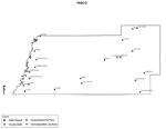
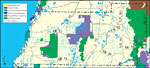
Southwest Florida Water Management District- Pasco County, September 28, 2004
This is a county detail map of Pasco County extracted from the Southwest Florida Watershed Management District or SWFWMD district map, created on September 28, 2004. This map shows major inland water, township/range lines (in pink), county boundaries...

First Previous


  FL Maps > County > Pasco
Site Map  

Maps ETC is a part of the Educational Technology Clearinghouse
Produced by the Florida Center for Instructional Technology © 2007
College of Education , University of South Florida