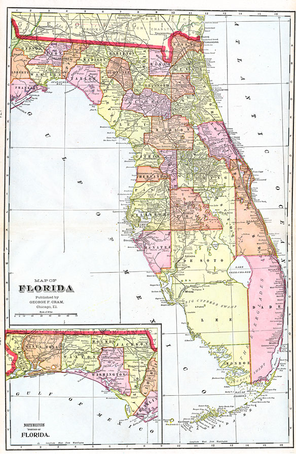
Description: A map of Florida showing county lines current to 1899, including each county seat and major towns. The railroad system extends as far south as Myers (Fort Myers) on the Gulf Coast, and Miami on the Atlantic Coast. Major rivers and wetlands are shown as well as the Florida Keys, and barrier islands. Longitude is shown as west from Greenwich at the top of the map and west of Washington at the bottom of the map. The northwestern panhandle (approximately west of the Apalachicola River) is shown on an inset map.
Source: George F. Cram, (Chicago, IL: George F. Cram Company, 1899) 174-175
Map Credit: Courtesy the private collection of Roy Winkelman. |
|