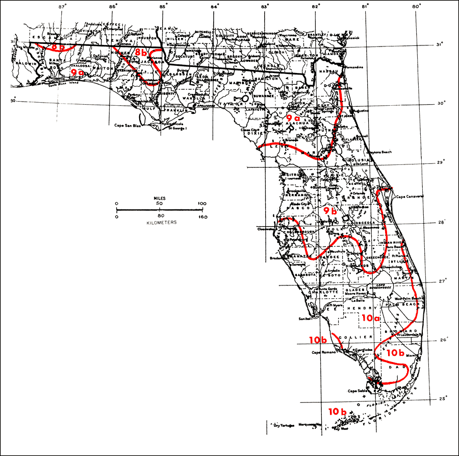
Description: "This Florida map is from the Plant Hardiness Zone Map of the contiguous United States prepared by the National Arboretum (USDA Agricultural Research Service 1965). The cold hardiness zones are based upon average minimum winter temperatures, that is, the lowest temperature in each year." —Elbert L. Little, Jr. The zones are as follows: Zone 8b, the coldest climate, 15 degrees; Zone 9a, 20 degrees; Zone 9b, 25 degrees; Zone 10a, 30 degrees; Zone 10b, 35 degrees. For more information, read the introduction to the Atlas of United States Trees Vol. 5 Florida.
Place Names: 1950-1999, Miami, Cape Canaveral, Daytona Beach, Fort Myers, St Petersburg, Tampa, Tallahassee, Jacksonville, Sarasota, Saint Augustine, West Palm Beach, Orlando, Apalachicola, Osceola, Ocala, Everglades National Park, Biscayne National Monument
ISO Topic Categories: boundaries, inlandWaters
Keywords: Plant Hardiness Zones, political, physical, physical features, major political subdivisions, county borders, boundaries, inlandWaters, Unknown,1978
Source: Elbert L. Little, Jr., Atlas of United States Trees Volume 5 Florida (Washington, DC: United States Government Printing Office, 1978)
Map Credit: Courtesy the private collection of Roy Winkelman. |
|