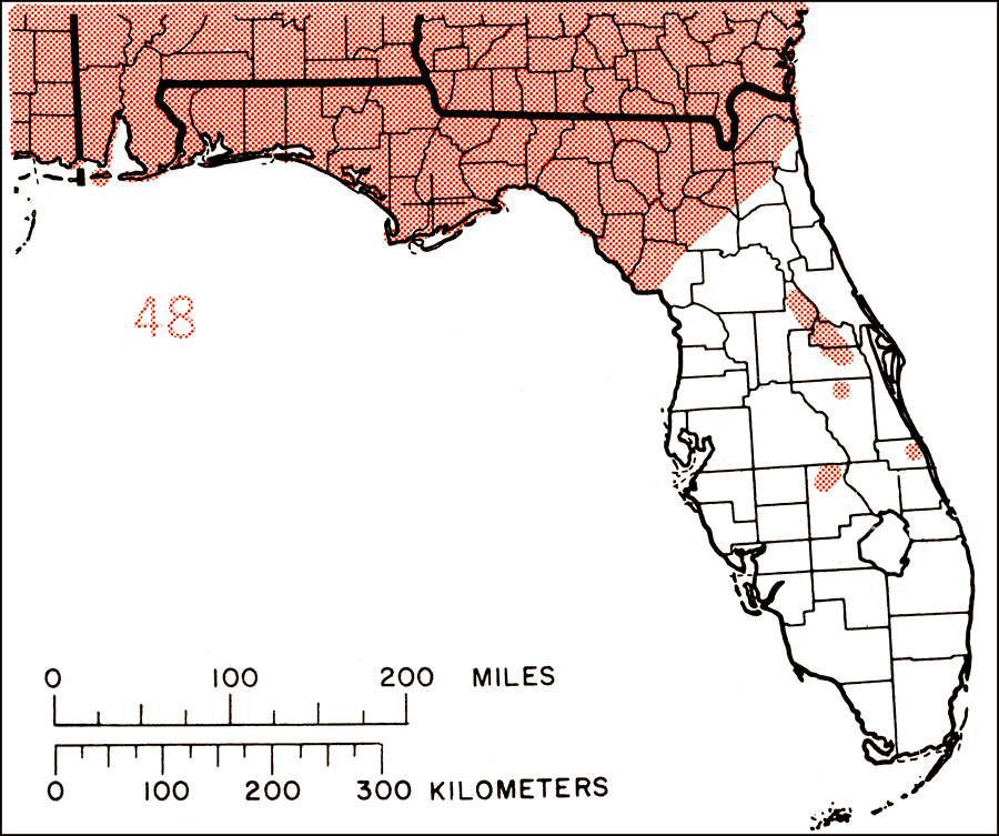
Description: This is a map showing the distribution of the Cyrilla racemiflora or swamp cyrilla in Florida. "Coastal plain from se. Va. to c. Florida and w. to se. Texas. Also West Indies in mts. from Cuba to Puerto Rico and Lesser Antilles. Atlantic Coast of C. America from Belize to Nicaragua, and n. S. America from Guyana to Venezuela, Columbia and Brazil." —Elbert L. Little, Jr. For more information, read the introduction to the Atlas of United States Trees Vol. 5 Florida.
Source: Elbert L. Little, Jr., Atlas of United States Trees Volume 5 Florida (Washington, D.C.: United States Government Printing Office, 1978)
Map Credit: United States Government Printing Office |
|