mapsExploring Florida
 FL Maps > Tree Distribution > Temperate Hardwoods C-H > Forestiera segregata or Florida-privet, 1978
Site Map 

Forestiera segregata or Florida-privet, 1978


Puzzle Directions: Click on a puzzle piece and drag it where you want it. When you connect two pieces correctly, they will join together. Mix up the pieces again. View finished map in pop-up window.

Title: Forestiera segregata or Florida-privet
Projection: Unknown
Source Bounding Coordinates:
W: E: N: S:

Back to Map Page
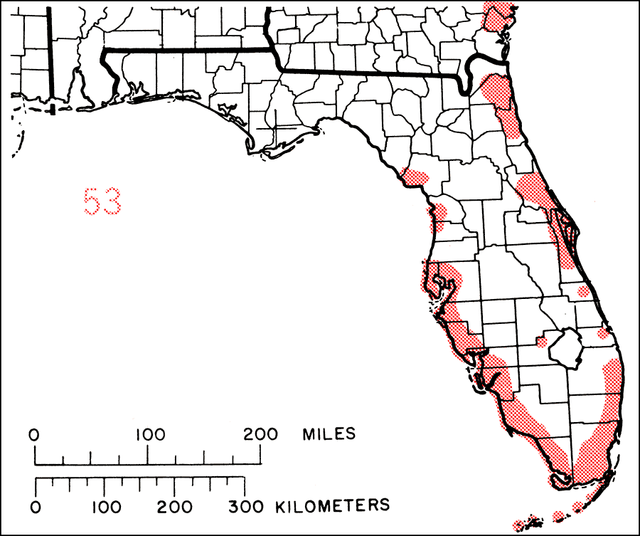
Description: This is a map showing the distribution of the Forestiera segregata or Florida-privet in Florida. "Along and near coasts from se. Georgia and ne. Florida s. to Florida Keys and n. on Gulf Coast to w. Florida (Levy Co). Also Bermuda, Bahamas, Greater Antilles to Puerto Rico and Virgin Islands, and Antigua." —Elbert L. Little, Jr. For more information, read the introduction to the Atlas of United States Trees Vol. 5 Florida.
Source: Elbert L. Little, Jr., Atlas of United States Trees Volume 5 Florida (Washington, D.C.: United States Government Printing Office, 1978)
Map Credit: United States Government Printing Office
SearchLicensePDF HelpGIS Help Google Earth Help Zoomify Help

 FL Maps > Tree Distribution > Temperate Hardwoods C-H > Forestiera segregata or Florida-privet, 1978