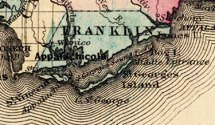
Description: This detail of a map of Florida was "Entered according to Act of Congress in the year 1863 by A. J. Johnson in the clerks office of the District Court of the United States for the Southern District of New York." It shows Franklin County in color, towns, villages, county seats, forts, railroads, and roads. The main features of the detail are Appalachicola and Cape Saint George.
Place Names: Franklin, Appalachicola, Apalachicola, Lake Wimico, Saint Vincents Bay, Saint Vincent Island, Saitn Georges Sound, Saint Georges Island, Dog Island,
ISO Topic Categories: boundaries, inlandWaters, oceans, transportation
Keywords: Franklin County, physical, political, historical, transportation, physical features, county borders, railroads, roads, water routes, boundaries, inlandWaters, oceans, transportation, Unknown,1863
Source: Johnson, A.J., Johnson's New Illustrated Family Atlas (New York, NY: Johnson and Ward, 1863) 40
Map Credit: Courtesy the private collection of Roy Winkelman. |
|