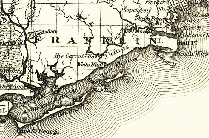
Description: This detail of a map of Florida covers Franklin County and vicinity and indicates drainage, cities and towns, township and county boundaries, railroads, and the 15-mile railroad land grant limits surrounding the track. The major water features of the detail include the Apalachicola River and Saint Georges Sound. Some of the townships listed are James Island and Dog Island.
Place Names: Franklin, Fort Gadsden, Saint Georges Sound, Saint Georges Island, Cape Saint George, Dog Island, Rio Carrabello, White Bluff, James Island, New River, Apalachicola, Apalchicola River,
ISO Topic Categories: boundaries, inlandWaters, oceans, transportation
Keywords: Franklin County, physical, political, transportation, physical features, major political subdivisions, county borders, railroads, boundaries, inlandWaters, oceans, transportation, Unknown,1882
Source: G.W. & C.B. Colton, (New York, NY: G.W. & C.B. Colton & Co. , 1882)
Map Credit: Courtesy of the Geography and Map Division of the Library of Congress |
|