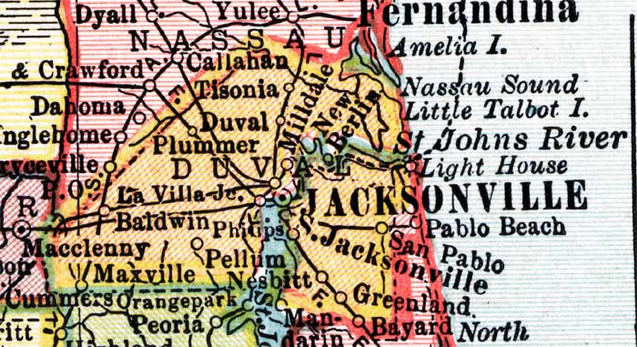
Description: This detail of a map of Florida shows county boundaries, roads, cities, towns, villages, lakes, and rivers current to 1910 for Duval County. On the main map, counties and major cities and towns are listed along the left and bottoms edges with corresponding coordinates. The counties are also colored for ease of differentiation. The main features of this detail includeJacksonville, Duval, and Maxville.
Place Names: Duval, Tisonia, Milldale, New Berlin, Amelia Island, Nassau Sound, Little Talbot Inlet, Saint Johns River, Light House, Jacksonville, Pablo Beach, San Pablo, Greenland, Pellum, Nes bitt, Maxville, Baldwin, La Villa, Plummer, Duval
ISO Topic Categories: boundaries, transportation, inlandWaters, oceans
Keywords: Duval County, physical, political, transportation, swamps, everglades, wetlands, physical features, county borders, roads, boundaries, transportation, inlandWaters, oceans, Unknown,1910
Source: , Atlas of the World (New York, NY: C.S. Hammond & Company, 1910) 84
Map Credit: Courtesy the private collection of Roy Winkelman. |
|