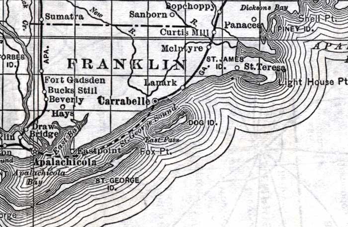
Description: This detail of a map of Florida shows railroads and major cities and towns current to 1920 for Franklin County. Major waterways are present, though secondary to the railways functions. Featured cities in this detail include Carrabelle, Saint Teresa, and Lanark.
Place Names: Franklin, Curtis Mill, McIntyre, Saint James, Saint Teresa, Lanark, Carrabelle, Dog Island, Hays, Beverly, Bucks Still, Fort Gadsden, Draw Bridge, Apalchicola, Apalachicola Bay, Saint George Island, Fox Point, Macintyre
ISO Topic Categories: boundaries, transportation, inlandWaters, oceans
Keywords: Franklin County, physical, political, transportation, swamps, everglades, wetlands, physical features, county borders, railroads, boundaries, transportation, inlandWaters, oceans, Unknown,1920
Source: , (, : US Railroad Administration, 1920)
Map Credit: Courtesy the private collection of Roy Winkelman. |
|