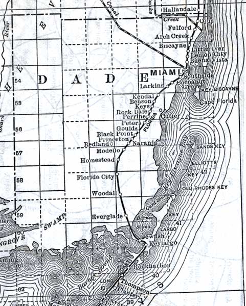
Description: This detail of a map of Florida shows railroads and major cities and towns current to 1920 for Dade County. Major waterways are present, though secondary to the railways functions. Featured cities in this detail include Miami, Cutler, and Biscayne.
Place Names: Dade, Miami, Fulford, Arch Creek, Biscayne, Littleriver, Lemon City, Buena Vista, Southside, Cocoanut, Cape Florida, Cutler, Sands Key, Elliotts, Old Rhodes Key, Key Largo, Jewfish, Everglade, Woodal, Florida, City, Homestead, Modell, Redland, Benson, Larkins, Key Biscayne, Larkin, Naranja,
ISO Topic Categories: boundaries, transportation, inlandWaters, oceans
Keywords: Dade County, physical, political, transportation, swamps, everglades, wetlands, physical features, county borders, railroads, boundaries, transportation, inlandWaters, oceans, Unknown,1920
Source: , (, : US Railroad Administration, 1920)
Map Credit: Courtesy the private collection of Roy Winkelman. |
|