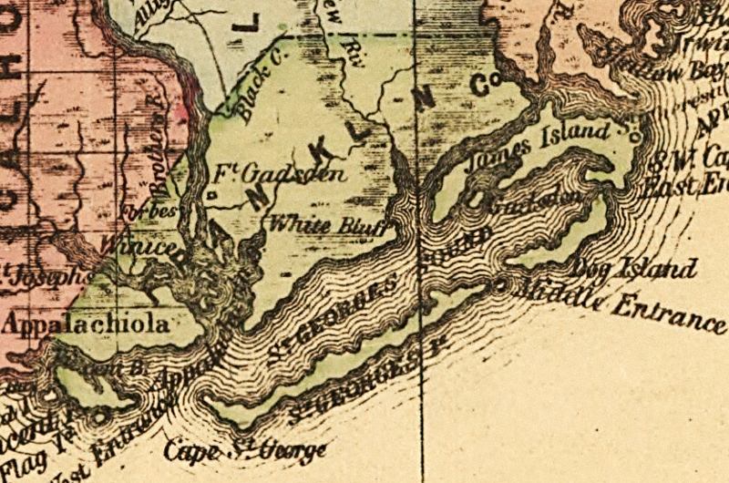
Description: This detail of a map of Florida indicates Franklin County current to 1874. It shows drainage, township and county boundaries, cities and towns, battlefields, and submarine cables to Havana. It also lists operating and newly chartered railroads of the time. Some of the features shown are White Bluff and Apalchicola.
Place Names: Franklin, Fort Gadsden, Black Creek, White Bluff, Saint Georges Sound, James Island, Gadsden, Dog Island, Saint Georges Island, Cape Saint George, Appalachicola Bay, Apalachicola Bay, Appalachicola, Apalachicola, Saint Vincent Island, Vincent Bay,
ISO Topic Categories: inlandWaters, location, oceans, transportation
Keywords: Franklin County, political, transportation, historical, county borders, roads, railroads, other military, inlandWaters, location, oceans, transportation, 1874
Source: Columbus Drew, LC Railroad Maps (Jacksonville, FL: Columbus Drew, 1874) 195
Map Credit: Courtesy of the Library of Congress, Geography and Map Division. |
|