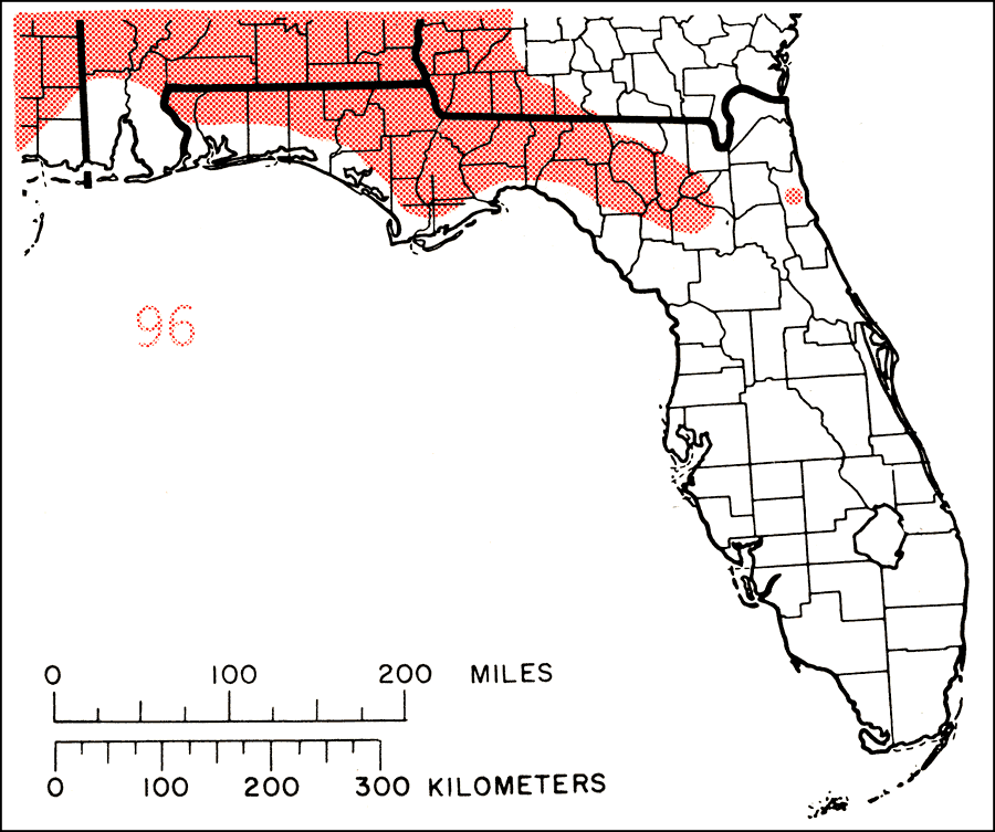
Description: This is a map showing the distribution of the Ostrya virginiana or eastern hophornbeam in Florida. "Cape Breton Is., P.E. Is., N.S., N.B., s. Quebec, and Maine, w. to s. Ontario, n. Michigan, n. Minnesota, and se. Man., s. to e. N. Dakota, Black Hills of S. Dakota, and Wyoming, n. Nebraska, e. Kansas, e. Oklahoma, and e. Texas, and e. to n. Florida. Also in mts. of Mexico, s. El Salvador and Honduras." —Elbert L. Little, Jr. For more information, read the introduction to the Atlas of United States Trees Vol. 5 Florida.
Source: Elbert L. Little, Jr., Atlas of United States Trees Volume 5 Florida (Washington, D.C.: United States Government Printing Office, 1978)
Map Credit: United States Government Printing Office |
|