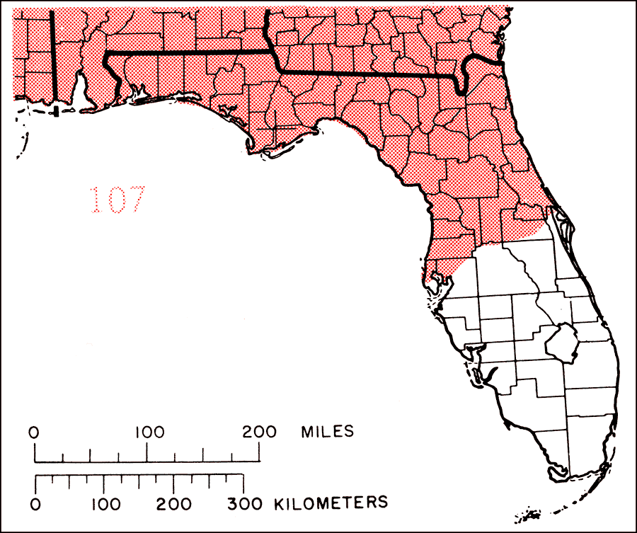
Description: This is a map showing the distribution of the Prunus serotina or black cherry in Florida. "N.S., N.B., and Maine, w. to s. Quebec, s. Ontario, n. Michigan, and e. Minnesota, s. to Iowa, extreme e. Nebraska, e. Oklahoma, and e. Texas, and e. to c. Florida. Also vars. in c. Texas (Edwards Plateau) and mts. from Trans-Pecos Texas w. to c. Arizona, s. in Mexico to Guatemala. Also s. B. Cal. Sur and Revillagigedo Is." —Elbert L. Little, Jr. For more information, read the introduction to the Atlas of United States Trees Vol. 5 Florida.
Source: Elbert L. Little, Jr., Atlas of United States Trees Volume 5 Florida (Washington, D.C.: United States Government Printing Office, 1978)
Map Credit: United States Government Printing Office |
|