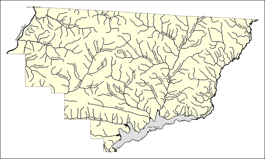
Description: This map was created by FCIT and shows the waterways of Gadsden County. All major rivers, streams, creeks, lakes, and swamps are labeled. This map features Shaw Creek, Mill Creek, Swamp Creek, Salem Branch, Willacoocee Creek, Attapulgus Creek, Salem Branch, Mosquito Creek, South Mosquito Creek, Pitman Branch, McDonald Branch, Hurricane Branch, English Branch, Little Teloia Creek, Tallahassee Creek, Teloia Creek, Juniper Creek, Camp Creek, Cane Creek, Bear Creek, Ocklawaha Creek, McIntosh Branch, Lake Talquin, Mule Creek, Hunter Creek, Monroe Creek, Hurricane Creek, the Little River, G Creek, Richlander Creek, Cox Creek, Vote Creek, Sweetwater Branch, Robinson Branch, Quincy Creek, Hubbert Branch, Hog Creek, Holley Branch, the Ochlockonee River, Lake Seminole, the Apalachicola River, Flat Creek, Station Branch, Yon Creek, Billy Branch, and Pittman Creek.
Source: Florida Center for Instructional Technology, (Tampa, FL: University of South Florida, 2008)
Map Credit: Courtesy of the Florida Center for Instructional Technology |
|