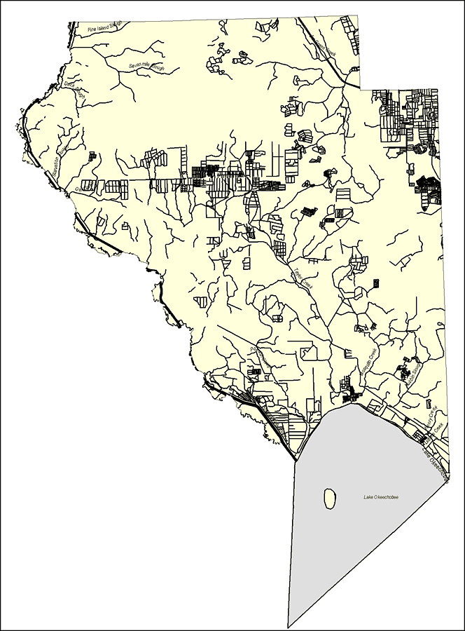
Description: This map was created by FCIT and shows the waterways of Okeechobee County. All major rivers, streams, creeks, lakes, and swamps are labeled. This map features Lake Okeechobee, Lettuce Creek, Henry Creek, Nubbin Slough, Mosquito Creek, Popash Slough, Taylor Creek, Jim Green Creek, Sevenmile Slough, Pine Island Slough, Duck Slough, Starvation Slough, and Oak Creek.
Place Names: Okeechobee, Lake Okeechobee, Lettuce Creek, Henry Creek, Nubbin Slough, Mosquito Creek, Popash Slough, Taylor Creek, Jim Green Creek, Sevenmile Slough, Pine Island Slough, Duck Slough, Starvation Slough, Oak Creek,
ISO Topic Categories: boundaries, inlandWaters
Keywords: Florida Waterways: Okeechobee County Outline, political, physical, kriversandstreams, physical features, county borders, photograph in shape of map, photo, Florida mapboundaries, inlandWaters, 2008
Source: Florida Center for Instructional Technology, (Tampa, FL: University of South Florida, 2008)
Map Credit: Courtesy of the Florida Center for Instructional Technology |
|