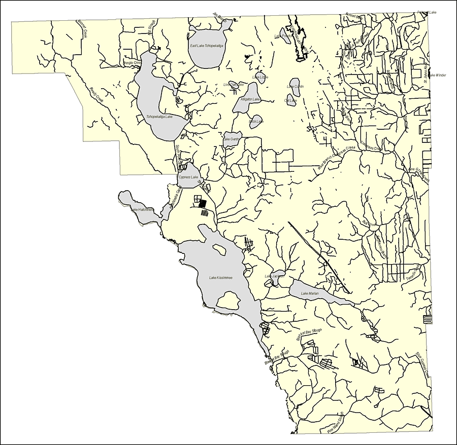
Description: This map was created by FCIT and shows the waterways of Osceola County. All major rivers, streams, creeks, lakes, and swamps are labeled. This map features Bonnet Creek, Shingle Creek, Reedy Creek, Mill Slough,Jim Branch, East Lake Tohopekaliga, Tohopekaliga Lake, Live Oak Lake, Alligator Lake, Lake Lizzie, Brick Lake, Lake Gentry, South Port Canal, Cypress Lake, Short Canal, Hatchineha Canal, Lake Hatchineha, Lake Conlin, Cat Lake, Lake Preston, Econlockhatchee River, Elbow Branch, Catfish Creek, South Fork Taylor Creek, Bonnet Gully, South Fork Taylor Creek, Boggy Branch, St. Johns River, Lake Winder, Poinsett Lake, Crabgraass Creek, West Branch Crabgrass Creek, Jane Green Creek, Bull Creek, Rauselerson Branch, Lake Kissimmee, Lake Jackson, Lake Marian, Tenmile Creek, Blanket Bay Slough, Blue Cypress Creek, Pine Island Slough, and Blue Cypress Creek.
Source: Florida Center for Instructional Technology, (Tampa, FL: University of South Florida, 2008)
Map Credit: Courtesy of the Florida Center for Instructional Technology |
|