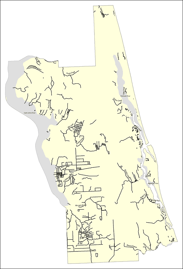
Description: This map was created by FCIT and shows the waterways of Saint Johns County. All major rivers, streams, creeks, lakes, and swamps are labeled. This map features Cabbage Creek, Flora Branch, Cunningham Creek, Burbin Creek, Trout Creek, Capo Creek, Tolomato River, Stokes Creek, Indian Creek, Saint Johns River, Mill Creek, Sixmile Creek, Mooultrie Creek, East Creek, Matanzas River, Moses Creek, Matanzas River, Moccasin Branch, McCullough Creek, Stevens Branch, and Deep Creek.
Source: Florida Center for Instructional Technology, (Tampa, FL: University of South Florida, 2008)
Map Credit: Courtesy of the Florida Center for Instructional Technology |
|