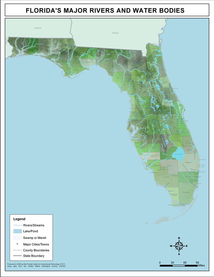
Description: This map was created by FCIT and shows the waterways of Florida. This map was produced with data from the United States Geological Survey (USGS). All major rivers, streams, creeks, lakes, ponds, swamps, and marshes are depicted. Each county is labeled as well as the largest water bodies. Some of these include Escambia River, Apalchicola River, Lake Talquin, Wakulla River, Suwannee River, Santa Fe River, Nassau River, Saint Johns River, Lake George, Withlacoochee River, Econlockhatchee River, Hillsborough River, Kissimmee River, Peace River, Myakka River, Lake Okeechobee, and Caloosahatchee River.
Place Names: 2000-, Cross Branch, Moccasin Creek, Little River, Okefenokee Swamp, Middle Prong Saint Marys River, Bill Branch, Bluff Creek, Calkins Creek, Cedar Creek, South Prong Saint Marys River, Bay Branch, Turkey Creek, Oak Branch, New River, Ocean Pond, Olustee Creek
ISO Topic Categories: boundaries, inlandWaters
Keywords: Florida's Major Rivers and Water Bodies, political, physical, kriversandstreams, physical features, county borders, photograph in shape of map, photo, Florida mapboundaries, inlandWaters, 2008
Source: Florida Center for Instructional Technology, (Tampa, FL: University of South Florida, 2008)
Map Credit: Courtesy of the Florida Center for Instructional Technology |
|