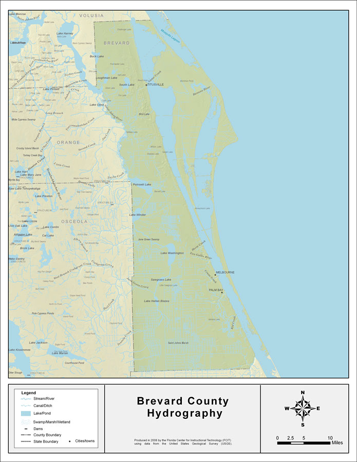
Description: This map was created by FCIT and shows the waterways of Brevard County. All major rivers, streams, creeks, lakes, and swamps are labeled. This map features Buck Lake, Loughman Lake, South Lake, Saint Johns River, Indian River, Banana Creek, Banana River, Indian River, Poinsett Lake, Lake Winder, Lake Washington, Eau Gallie River, Horse Creek, Crane Creek, Sawgrass Lake, Jane Green Creek, Lake Hellen Blazes, Kid Creek, and Tenmile Cree.
Source: Florida Center for Instructional Technology, (Tampa, FL: University of South Florida, 2008)
Map Credit: Courtesy of the Florida Center for Instructional Technology |
|