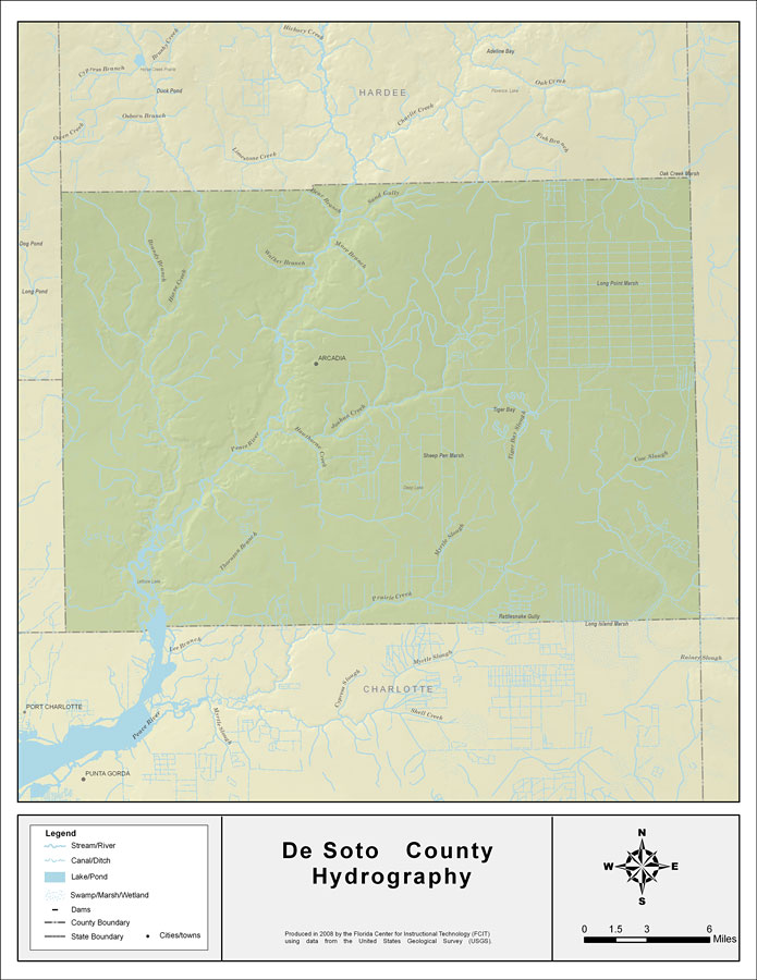
Description: This map was created by FCIT and shows the waterways of DeSoto County. All major rivers, streams, creeks, lakes, and swamps are labeled. This map features Brandy Branch, Horse Creek, Walker Branch, Mare Branch, Bear Branch, Sand Gully, Peace River, Hawthorne Creek, Joshua Creek, Oak Creek, Cow Slough, Tiger Bay Slough, Myrtle Slough, Prairie Creek, and Thornton Branch.
Source: Florida Center for Instructional Technology, (Tampa, FL: University of South Florida, 2008)
Map Credit: Courtesy of the Florida Center for Instructional Technology |
|