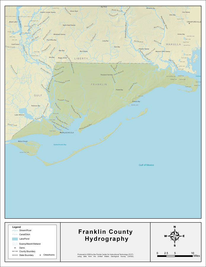
Description: This map was created by FCIT and shows the waterways of Franklin County. All major rivers, streams, creeks, lakes, and swamps are labeled. This map features the Ocklockonee River, the Crooked River, Gully Branch, the New River, Gator Creek, Cat Creek, Trout Creek, Hog Branch, Black Creek, Devon Creek, Brickyard Creek, Fort Gadsden Creek, Bearman Creek, the Brothers River, the East River, Sand Beach Branch, Graham Creek, Chipley Creek. the Jackson River, the Apalachicola River, and Pine Log Creek.
Place Names: Franklin, Ocklockonee River, Crooked River, Gully Branch, New River, Gator Creek, Cat Creek, Trout Creek, Hog Branch, Black Creek, Devon Creek, Brickyard Creek, Fort Gadsden Creek, Bearman Creek, Brothers River, East River, Sand Beach Branch, Graham Creek, Chipley Creek, Jackson River, Apalachicola River, Pine Log Creek, Apalachicola
ISO Topic Categories: boundaries, inlandWaters
Keywords: Florida Waterways: Franklin County , political, physical, kriversandstreams, physical features, county borders, photograph in shape of map, photo, Florida mapboundaries, inlandWaters, 2008
Source: Florida Center for Instructional Technology, (Tampa, FL: University of South Florida, 2008)
Map Credit: Courtesy of the Florida Center for Instructional Technology |
|