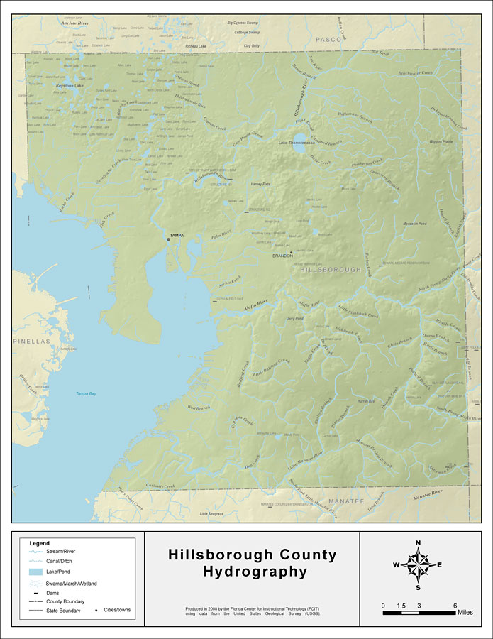
Description: This map was created by FCIT and shows the waterways of Hillsborough County. All major rivers, streams, creeks, lakes, and swamps are labeled. This map features Keystone Lake, Rocky Creek, Sweetwater Creek, Fish Creek, Archie Creek, Curiosity Creek, Brusshy Creek, Sherrys Brook, Cypress Creek, Hillsborough River, Lake Thonotosassa, Baker Creek, Flint Creek, Campbell Branch, Hollomans Branch, the New River, Indian Creek, Big Ditch, Pemberton Creek, Spartman Branch, English Creek, Itchepackesassa, Blackwater Creek, Howell Branch, Turkey Creek, the Alafia River, North Prong Alafia River, Thirtymile Creek, Little Fishhawk Creek, Fishhawk Creek, Bell Creek, Boggy Creek, Little Bullfrog Creek, Bullfrog Creek, Wolf Branch, Cockroach Creek, Dug Creek, the Little Manatee River, Howard Prairie Branch, Alderman Creek, Hurrah Creek, South Prong Alafia River, Halls Branch, Chito Branch, Owens Branch, Mizelle Creek, and West Branch.
Source: Florida Center for Instructional Technology, (Tampa, FL: University of South Florida, 2008)
Map Credit: Courtesy of the Florida Center for Instructional Technology |
|