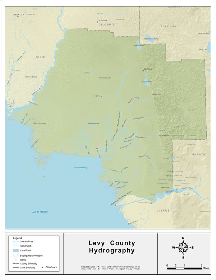
Description: This map was created by FCIT and shows the waterways of Levy County. All major rivers, streams, creeks, lakes, and swamps are labeled. This map features the Gopher River, the Suwannee River, the Waccasassa River, Chunky Pond, Magee Branch, Mule Creek, the Wekiva River, Calf Branch, Porter Slough, Cow Creek, Cabbage Drain, Bullfrog Creek, Otter Creek, Jacks Creek, Station Pond, East Griffin Creek, Kelly Creek, Mud Creek, Bird Creek, Double Barrel Creek, Tenmile Creek, Sapling Branch, Spring Run, Turtle Creek, Thousandmile Creek, Demory Creek, Jones Creek, and Lake Rousseau.
Source: Florida Center for Instructional Technology, (Tampa, FL: University of South Florida, 2008)
Map Credit: Courtesy of the Florida Center for Instructional Technology |
|