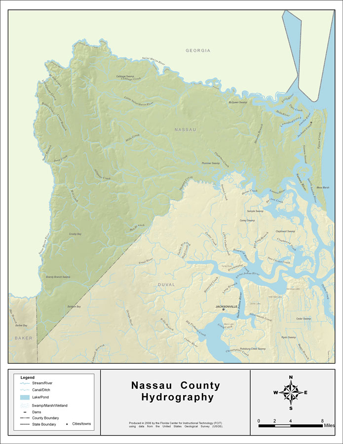
Description: This map was created by FCIT and shows the waterways of Nassau County. All major rivers, streams, creeks, lakes, and swamps are labeled. This map features Upper Sister Creek, Lower Sister Creek, Bells River, Saint Marys River, Jolly River, Tiger Creek, Saint Joseph Creek, Egans Creek, Blounts Branch, Lanceford Creek, Amelia River, Jackson Creek, South Amelia River, Alligator Creek, Lumber Creek, Nassau River, Plummer Creek, Mills Creek, Little Saint Marys River, Cossiers Creek, Cabbage Creek, St. Marys River, Brush Creek, Little Dunn Creek, Dunn Creek, Pigeon Creek, Cross Branch, Stave Branch, Deep Creek, Ben Branch, Thomas Creek, and Mill Creek.
Source: Florida Center for Instructional Technology, (Tampa, FL: University of South Florida, 2008)
Map Credit: Courtesy of the Florida Center for Instructional Technology |
|